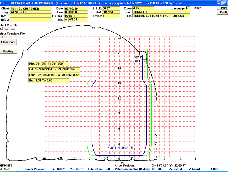

Measured by L-KOPIA CLEARANCE LASER
(c) L-KOPIA
| Client : | TUNNEL CUSTOMER |
| Date measured : | 03/10/09 |
| Track segment : | WEST SUB. |
| Track number : | MAIN 1 |
| Direction : | WEST |
| Curve & S.ELE : | 4.017 00.5" |
| Distance & Structure : | 004.951 004.960 TUNNEL 1 |
| GPS (Lat/Long/Hgt) From : | 39.99627994,-75.19639142,9.54 |
| GPS (Lat/Long/Hgt) To : | 39.99641384,-75.19634577,9.68 |
| File & frame No. (mode) : | 001 06 (C) |
The L-KOPIA/LKO ClearLoad Program © has several design options for the end result (scale and grids for Imperial & Metric, with or without clearance distances on plots, Safety Margins shown on Plots, etc.). The ClearLoad software also includes a “Routing Option”, with customized “System Maps”. Plots can be sent to printers, plotters and to PDF-printing.