L-KOPIA / LKO Surveying Laser System |
||
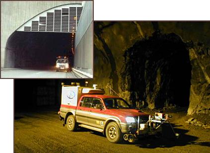
LKO SURVEYING LASER SYSTEM is used for fast, high accuracy surveying of tunnels, railways, roads, etc. It consists of a laser unit linked to a personal computer, equipped with our specially designed software. The Surveying software can handle on-line communication (laser positioning up to 5 times per second) with Total Stations and GPS. We use a class I laser, invisible and harmless to the naked eye. |
||
|
||
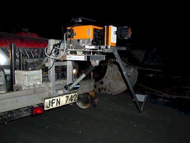
The measuring range is up to 30 meters (90 ft.) as it scans 270 degrees with a speed of 8 laps per second collecting a maximum of 3,600 points each second. |
||
|
||
Accuracy is determined by the number of scans on any particular object. With a single scan the average deviation is ± 18 mm (± 5/8 inch) compared to 30 scans with an average deviation of ± 4 mm (± 1/8 inch). Within the measuring range, test results will not be altered by the distance of the scanned object. It takes only four (4) seconds to measure one (1) cross section with the higher accuracy ± 4 mm (± 1/8 inch), including 450 points (X, Y and Z coordinates). |
||
|
||
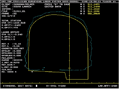
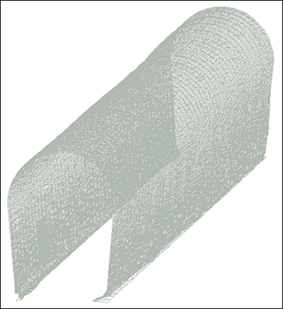
With the designed software, immediate results are produced on a graph of the structure being measured. This output can be coded on site or in remote locations. The final results consist of a heading with all specifics such as cross section, curves, name and numbers of structures, as well as coordinates in X, Y and Z. The system also handles continuous minimum registration for tunnels, etc. Several optional software packages, such as plot and cross section programs are available as is additional software for other applications (such as GEO-12). |
||
|
||